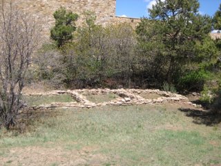
If I could sum up my entire weekend and give one piece of advice, it would be: "Chaco is a must-see for anyone that is even remotely interested in Native American culture or history or great feats of mankind, even in the least!!!" The place is so great that this blog and my pictures really don't do it justice. To be able to stand inside those Great Houses and realized that someone built these four and five story complexes (at a time when the highest buildings in the world were only one and two stories high) in a desert with temperature extremes ranging from -38 degrees to 117 degrees, where the shortest distance that they hauled wood from (by carrying it) was 43 miles away, and all within a span of 400 years (where each Great House was built a part at a time ranging from 20 to 50 years)..it's just mind blowing.
That said on to the blog entry (WARNING I went into lecture mode as Em has so aptly named it, so if you don't like learning, I suggest you just look at the pretty pictures and OHHHH and AWWWW and maybe skim the text to learn what the pictures are of):
Josie, Josie's Husband, Ronnie, Darwin...
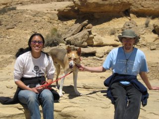
And Me...
Set out for Chaco Canyon on Friday night accompanied by a brilliant light show courtesy of the lightening storm taking place in New Mexico.
On our quest to this great Native American Mecca, we searched in vain for a pizza joint as I was craving the old comforts of collegiate food and something besides Taco Casserole (which is very good, but I get it about once a week). On this quest we discovered that the only pizza that we could find within a 100 mile radius of Cortez, Co (after we left the city limits) were Dominos, Pizza Hut and Giant Gasoline $0.99/slice. Quite a disappointment. After and hour and a half of looking, I gave in to the others' demand for food and we stopped at Dairy Queen. Quite possibly the worst fast food chicken sandwich I've had in a long long time. Also, never try Cherry Pepsi - waste of taste buds.
Tummies happish, we set out to tackle the next obstacle on our trip, the 16 mile trek into the park on a pitch black road that should have a warning sign attached to it that says, "Warning severe tire destruction imminent if you drive over 10 miles and hour, and still quite possible if you drive slower than 10 miles an hour." The road was absolutely crappy....and it was the better of the two roads into the park. Once we made it to the actual park entrance though, the car was rewarded with a paved road. We determined that the road was purposely made shitty to discourage all but the most determined and thus preserving the great archaeological sites from those un-deserving of them.
After setting up camp, it was off to bed in anticipation of the great sites that we would see the next day.
Since we had the puppy, Darwin, who's 4, so not really a puppy, but acts like one and is incredibly sweet, we had to trade off between which two people would explore the ruins and which person would wait at the car with Darwin. Then we'd switch. This made it a little harder to see everything, but in the end we only missed about four of the Great Houses (one that was easy to get to due to lack of energy at that point, and three that required hikes that we didn't have time for).
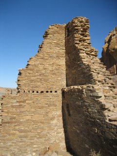
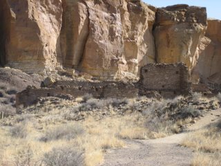
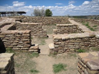
The Great House on our tour was Hango Pavi (no one remembers what this is supposed to have translated into). This was a medium sized Great House, but amazing none-the-less.
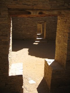
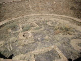
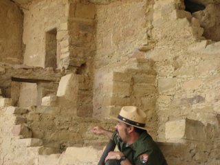
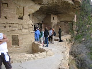
I got to go on a ranger guided tour of Pueblo Bonito with Ranger Corey, who was very knowlegable, but talked in a monotone, thus losing some of the awe, but the sites themselves made up for his lack of enthusiasm. When Pueblo Bonito was re-discovered by Richard Wetherill (also know for re-discovering most of Mesa Verde) only the top portions of the top walls could be seen. These walls were five stories high in some places. During a later excavation by the US Geological Survey, 100,000 tons of sand was removed from the Great House, thus allowing people to see at that is there. This is the most excavated Great House in the Park, I believe it was 85% excavated.
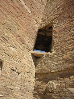
It's also got astrolonomical significance associated with it as there was a corner window that was knocked into the fourth story wall after the wall was built that lines up with an added portion of a wall on the inner side of the room, where a square of light shines on the Winter Solstice. There's also another "platform" on the same side of the complex that allows one to chart the sun's progress across the mountains through the entire year (if you add in the corner window - wall that marks time from October 31st to Winter Solstice). Pueblo Bonito is also aligned so that the center wall that divides the plaza in half is exactly in the East - West alignment and the left half of the front wall is exactly in the North - South alignment (the right half is at a 4 degree tilt). Engineers today could have built the walls any straighter if they used the most sophisticated instruments that we have available today.
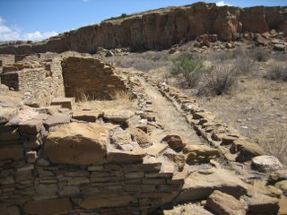
After Pueblo Bonito, I hit up Chetro Ketl which is only a quarter mile away. I never realized how close most of the great houses are to each other. There are I believe there are 10 Great Houses all within 6 miles of each other and you can pretty much spit from one to the next (aptly named "Downtown Chaco").
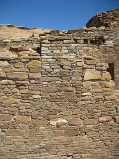

Chetro Ketl has one of (if not the only) example of colonnade support beams in Pueblo culture. This is a feature that is more traditionally associated with Greek or Roman architecture. The people that built that colonnade front later filled in the gaps to create a complete wall. Nobody knows why the built the colonnades in the first place or why they later filled in the gaps between them.
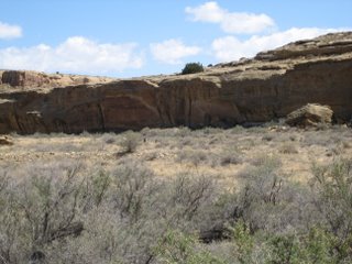
Behind Chetro Ketl is a check dam that was set up to help capture water.
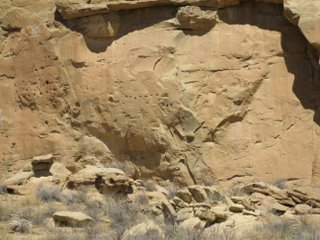
There are also perfect holes cut/chiseled into the cliff face behind the Great House that used to be where other roomblocks were (they are now rumble).
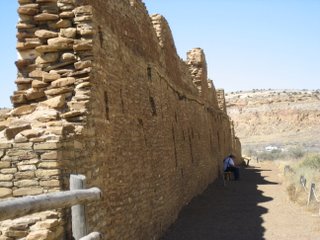
Also, when explorers first re-discovered the area, there were balconies coming off the backside of the main wall of the building.
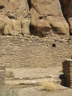
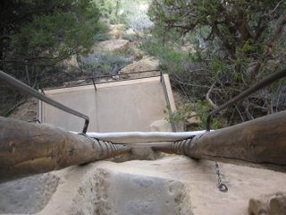
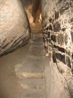
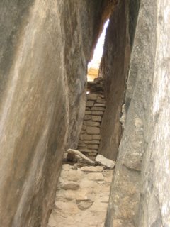
Through part of the building you can see the remnants of the staircase that lead from an ancient road, through the complex, up the cliff face, and then onward towards Pueblo Alto (which is about 1.5 miles further in on top of the mesa). It's amazing how they literally carved a staircase into the vertical rock face. When you go on the Pueblo Alto trail you can take an extra loop and travel to this staircase as well as another one called "Jackson's Staircase" and see them from the top down.
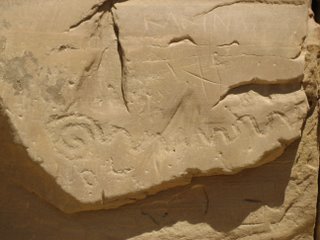
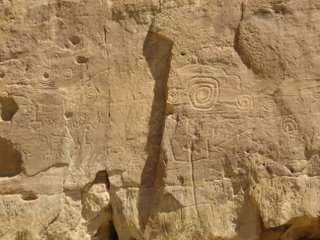
Between Chetro Ketl and Pueblo Bonito is a petroglyph (pecked rock art) trail. This trail has both Puebloan art...
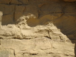
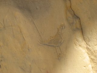
...and Navajo art on it. The Navajo lived in the park for a few hundred years after the Pueblo people abandoned their homes. The styles are very different, with Navajo petroglyphs being very line oriented.
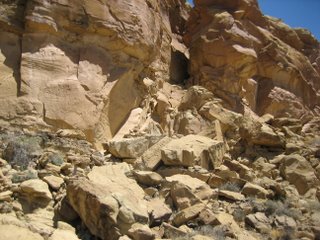
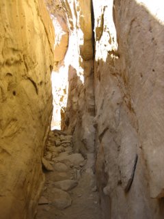
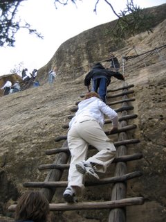
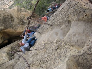
After a quick lunch, we set off for Pueblo Alto and New Alto. This was a 3.2 round trip hike that is in the backcountry so the Puppy was allowed to come. The thing that we didn't realize until we started was that the trail starts with a climb up the cliff face from the valley floor to the mesa top. At first we couldn't even tell how to do it and how we were going to get Darwin up there, but I lead the way and others followed. At about halfway, Josie and Ronnie decided that the way was too steep for the puppy and that they were going to turn around and go back. I decided to go forward and Darwin decided to follow me and thus proved to his parents that he was a rock-climbing dog after all, which was good since what I thought would be a quick 45 minutes there and back hike turned out to be 2+ hours.
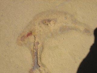
Mostly cause we stopped to look at every fossil (Ronnie's really into geology and they were neat). The trail up to the Great House goes by:
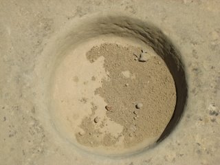
...A set of pecked basins. Darwin stood over these and created a really cool shadow that I tried to capture, but he kept putting his ears down when I took the picture.
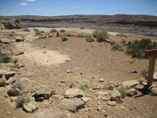
...A stone circle (purpose unknown)
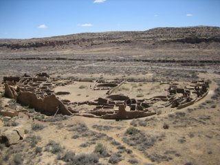
...And overlook that afforded a spectacular view of Pueblo Bonito. From there you could really see the "D" shape to the settlement and all the different parts.
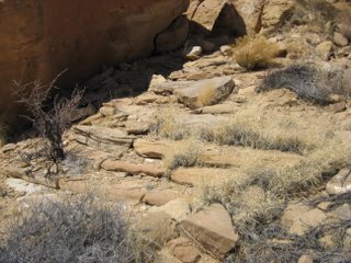
...Chacoan Stairs
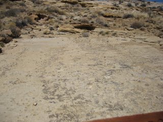
...and Part of a Chacoan Road
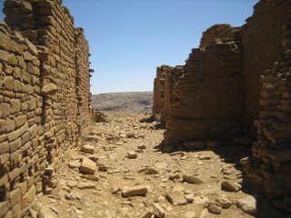
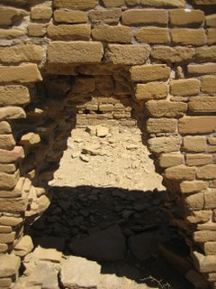
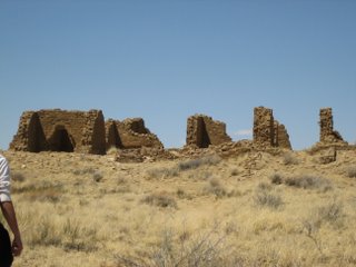
When we got to the Great House we realized that there was a smaller House, New Alto, next to it, as well as the "Mound of a Million Pots" (where archaeologists believe at least a million pots were broken, reason unknown), and a vantage point from which your can still see some of the many roads that once lead in an out of the area (I couldn't see them, but they're there).
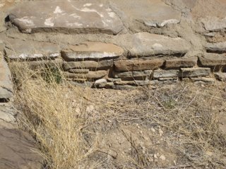
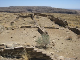
The above our pictures of Pueblo Alto.
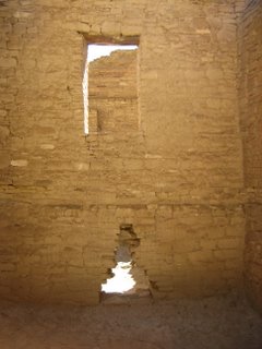
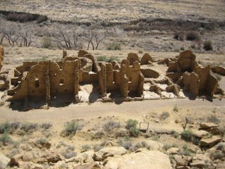
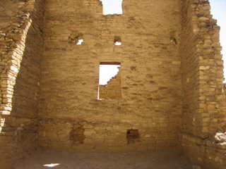
After returning down the mesa to the valley once more, we investigated Kin Kletso that sits at the base of the trail
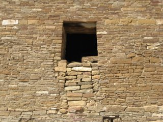
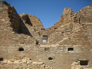
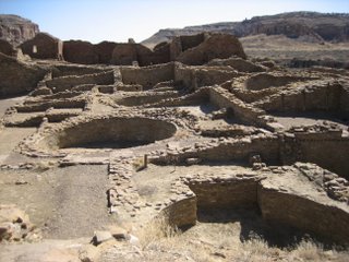
...and Casa Del Arroyo.
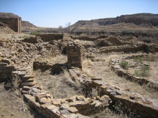
Casa Del Arroyo has the only tri-walled structure in the entire Chaco park and is one of only a dozen or so multi-walled structures ever found. There are three others in the general Chaco area and another eight in areas above the San Juan River (so Mesa Verde region and there abouts).
Thus concluded touring for Saturday. Saturday evening the skies were clear and the Park Service put on an astronomy program. Chaco has one of the darkest skies in America and thus it is a great place to view the stars from. using giant telescopes, we were able to see the waxing moon and Saturn up close and personal. Saturn was so clear that it looked like a glow in the dark sicker that someone had put on the inside of the telescope lens. It was really neat.
The presentation talked about the astronomical features that certain buildings in the park contained as well as the "Super Nova" pictograph that archaeologist believes represents the super nova that took place in 1034 AD around the end of June, beginning of July. The picture, which we hiked to on Sunday contains a sun/star symbol, which they think represents the exploding star itself, a waning moon that coincides with July 5th, 1034 AD (in the middle of the time that the super nova could be seen) and a hand whose middle finger points to the exact location in the sky that the super nova was. Whether any of this interpretation is true is still speculation though and probably will remain so forever (well until the time machine is invented).
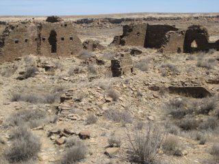
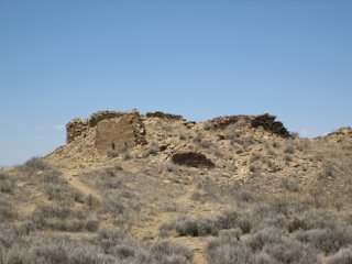
After packing up camp on Sunday we set out for Penesco Blanco which is a 7.8 mile hike round trip.
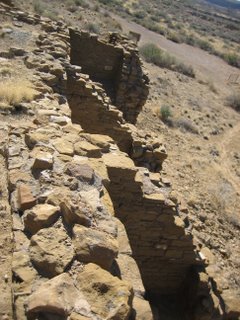
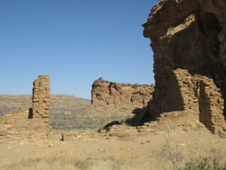
On the way we passed by Casa Chinquita, which lives up to its name (Small House). It is really small compared to some of the other Great Houses.
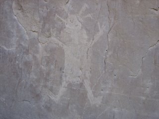
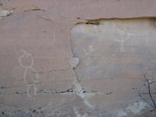
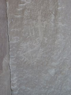
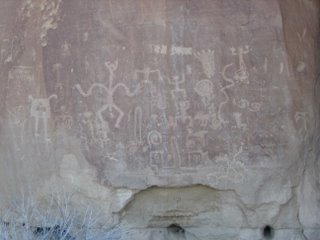
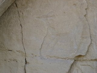
...We passed by tons of rock art and I think I have like 35 pictures from a one mile stretch (I took a picture of everything cause it's all were fascinating).
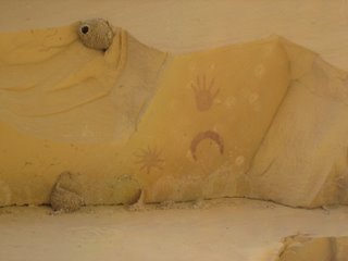
...and past the Supernova Pictograph.
On the way back, the puppy was so tired and hot that he tried to veer into every tiny patch of shade that there was (and some of these patches were really small too). It was so cute.
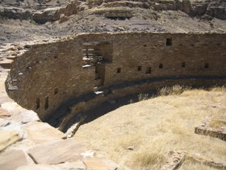
After out arduous journey, Josie and I had just enough energy to take a quite look at Casa Rinconada, the Great Kiva House. The Great House consists of some outlying roomblocks and in the center is a huge Great Kiva.
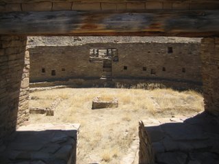
This kiva has two giant "T" shaped doors that are lined up perfectly on the North - South axis and a window that is off set next to one of them that cast light on to one of the numerous windows that ring the kiva sides on the Summer Solstice.
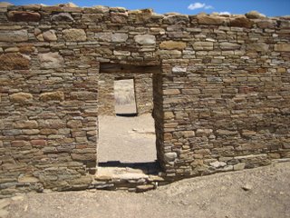
Also, in the ante-chamber the two doors are lined up exactly on the East - West axis and during the Spring and Fall equinoxes a shaft of light illuminated the space between the two.
Thus, three wary, but highly satisfied travelers began there bumpy trip back down the road of bumps and large holes to the world of modern civilization and the "Real World" as some would put it.
On a last side note, Sunday night I finally got my pizza at a snazzy joint back in Cortez.

